
This stunning 50km trail travels from Floe Lake trailhead to Paint Pots trailhead. The trail goes up and down three mountain passes, passing by glaciers, moraines, larches and many waterfalls. The Rockwall is challenging in many ways but worth the climb if your up to it.
Permits
As this is a national park, you must have backcountry permits. Permits usually release in January. Launch dates can be found on the Parks Canada website. The Rockwall trail is in Kootenay National Park which follows the Banff, Kootenay and Yoho launch usually. Last minute cancellations can be found on the parks Canada website or using cancellation apps, such as Schnerp.
The Trailhead
To do the entire Rockwall trail, you will need two cars. Park one at Paint Pots trail head and the other at Floe Lake. Floe Lake is a smaller lot and parking can be limited as people often day hike to Floe Lake. It is also possible to do a section of the trail and start at Numa Falls or circle back to either parking lot. The Numa Falls bridge is now up and working. All trailheads have outhouses.
The trail
We started at Floe Lake and did 5 days 4 nights. You can choose to do less or more. I will describe the trail in the order we hiked.
Day 1: floe lake
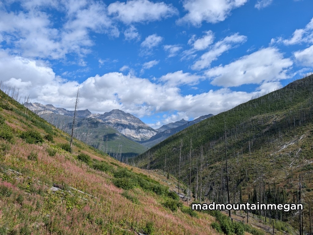
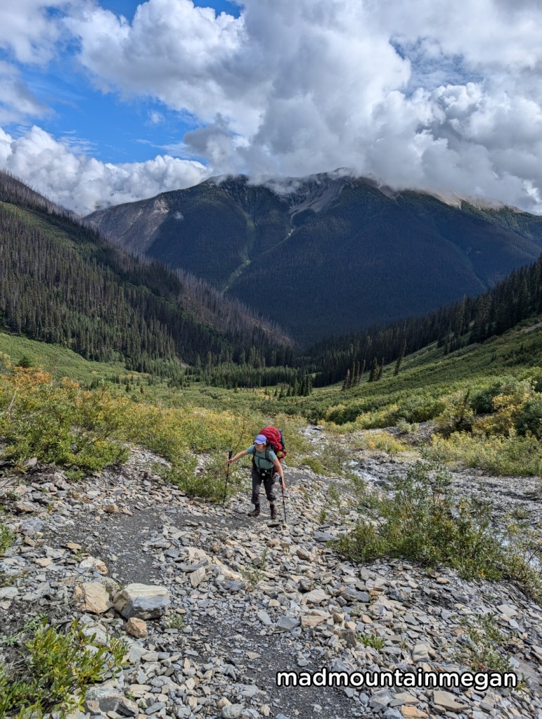
The hike starts as a flat walk through the forest, after crossing the river a couple times you are met with steady switchbacks. The trail levels off as you head around the mountains to the back of the valley. Traveling through the dead forest is exposed, there are a few places to fill water if needed. The last kilometer you hike up steep switch backs through the forest over the head wall. You know you are getting close when you start to see larches.
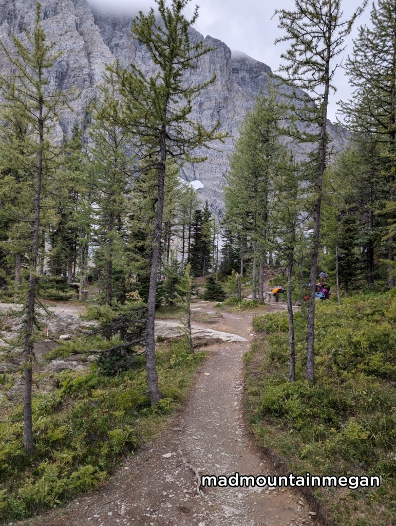
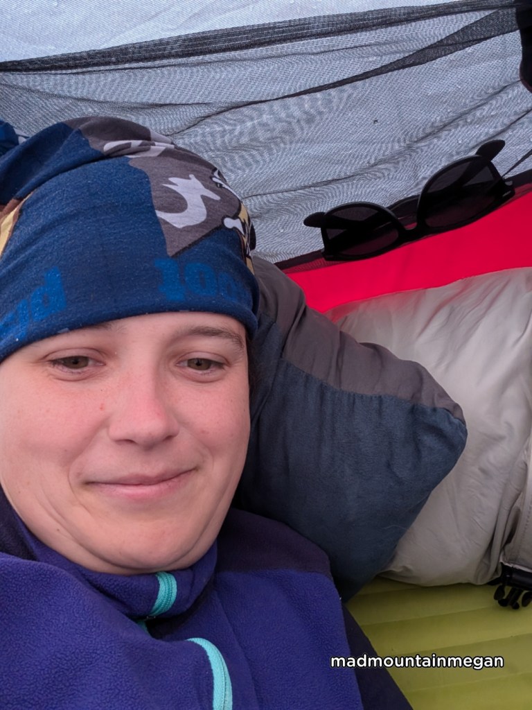
Floe Lake campground
Floe Lake campground has two areas, each area contains tent pads in the forest with a few near the lake. Two outhouses, two picnic areas and two bear bins. The campground was almost full when we came even though the next day was rainy. There is a moving creek closer to the second area, otherwise you can fill water at the lake. I suggest to use a filter as the lake water can be dirty with sediment.
Day 2: floe lake to numa creek
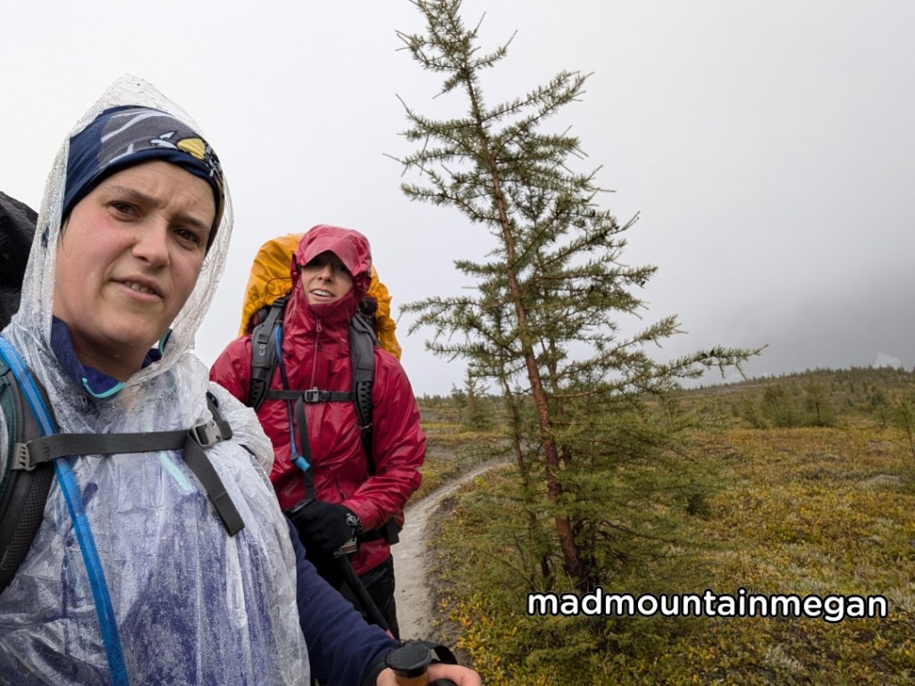
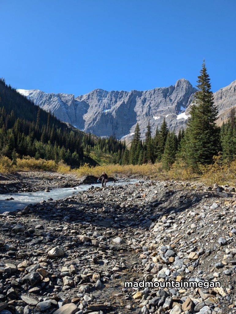
This day it poured rain so I do not have much to say in terms of scenery. The climb to Numa pass is about 300m on gentle switch backs once reaching the pass the trail is very open and you would have a good view of Floe Lake. At points where the trail may be confusing Parks Canada has added orange highlighted posts to follow. After Numa pass, follow the steep switch backs down the forest. The loss from the pass to the campground is about 800m. After descending the forest you are rewarded with glimpses of waterfalls. Hike through the willow bushes, we had rain gear but if the bushes are wet they could soak your clothes, rain gear may be good even if its not raining.
Numa creek campground
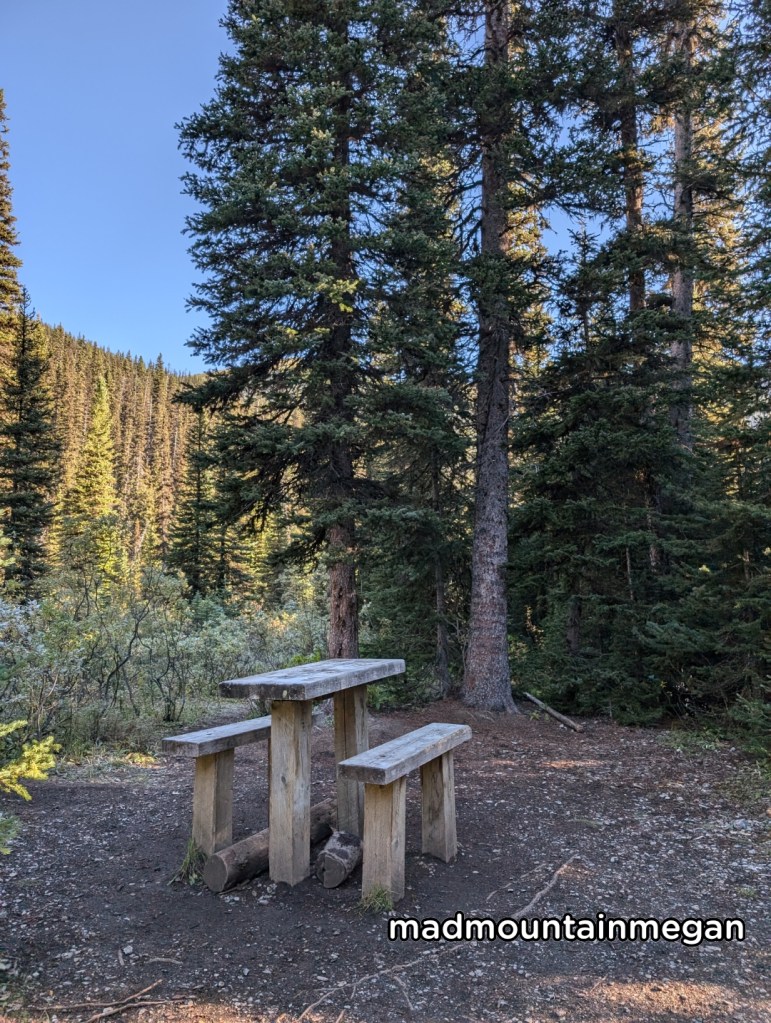
Numa creek is at the base of Numa Pass and Tumbling Pass. Between two creeks. There are a few tent pads near the creek and a few near the forest. There is one outhouse, one picnic area, and a few bear bins. The picnic tables are abnormally high. There are also several bench’s and logs to sit on. Numa also has fire pits and grills. The water source is good as it is a moving creek. Numa was wet when we were there from the rain, but talking to others who have previously been there, they say that Numa also has a lot of morning dew.
Day 3 numa creek to tumbling
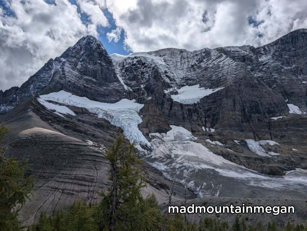
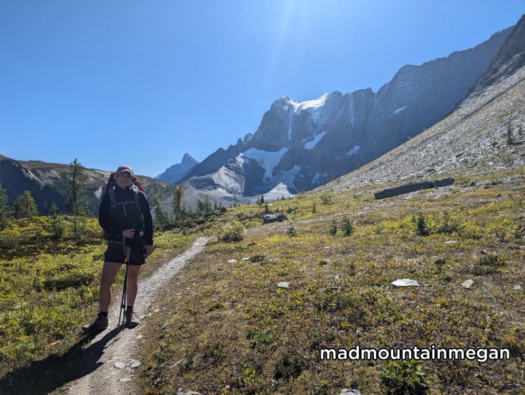
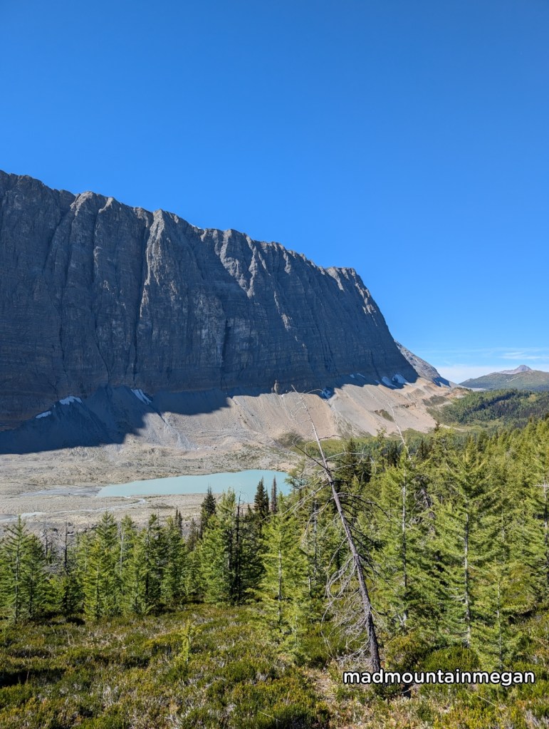
Leaving Numa you climb the tumbling pass an 800m gain. You steadily climb the willow bush forest until you are near the top of an avalanche gully. You then navigate a series of switch backs up the rocks. Crossing several streams there are opportunities to fill water. Prior to Tumbling Pass you climb steady up the larch forest. At the pass you can see many large boulders and hear screaming pikas. Walk through the gentle larch forest until you reach another steep up climb. This hill avoids the glacier moraine below to your left. Descending into Tumbling Creek you follow switch backs through the forest. Tumbling glacier is to your left. There are also several streams to fill up water. Prior to the campground you must cross a bridge over Tumbling Creek.
Tumbling creek campground
Tumbling creek campground is in an open meadow. There are many tent pads in the forest and around the meadow. There are two bear bin areas, two picnic areas, two outhouses. The water source is silty from the moraine above but we opted for a smaller stream beside the large creek to avoid the silt.
day 4 Tumbling creek to helmet falls
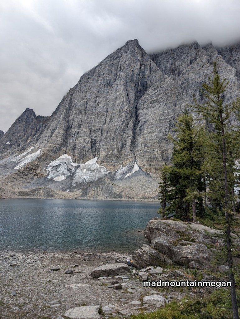
Climb steady up the switchbacks, while taking in the view of the Tumbling glacier. You soon reach the top of the pass, which is about a 300m gain, where it is steady flat for about 1 hour. The pass is open and very scenic. There are several streams to fill waters. You then enter the forest to descend down. After the forest, the path then crosses a bouldered moraine, the walking is still easy. Walk uphill one last time to leave the moraine area. Then go down again steady and steep switchbacks. The roots are slippery and there are many slippery rocks. You can see the massive helmet falls to the left.
Helmet falls campground
The campground has a good amount of tent pads with two out houses a few bear bins and picnic tables. The stream near by is fast flowing with no sediment.
Day 5 helmet to paint pots
Walking back to the trailhead you walk through the open forest with a few views of the mountains above. The trail is good and is mainly gentle down. Stopping at Helmet/Ochre Junction Campground for lunch. At the end you do pass the Ochre Paint Pots, which are interesting to check out.
Side notes
- Many people encountered grizzlies on the trail. We saw signs. Be prepared for bear encounters.
- This trail crosses 3 mountain passes. Do no underestimate elevation and how it can slow you down.
- We saw many Parks Canada staff. They were surveying and not checking permits. However it is good to carry your permit. It is nice to see them around.

Leave a comment